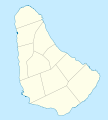
קובץ:Barbados location map.svg

גודל התצוגה המקדימה הזאת מסוג PNG של קובץ ה־SVG הזה: 539 × 599 פיקסלים. רזולוציות אחרות: 216 × 240 פיקסלים | 432 × 480 פיקסלים | 691 × 768 פיקסלים | 921 × 1,024 פיקסלים | 1,843 × 2,048 פיקסלים | 1,205 × 1,339 פיקסלים.
לקובץ המקורי (קובץ SVG, הגודל המקורי: 1,205 × 1,339 פיקסלים, גודל הקובץ: 125 ק"ב)
היסטוריית הקובץ
ניתן ללחוץ על תאריך/שעה כדי לראות את הקובץ כפי שנראה באותו זמן.
| תאריך/שעה | תמונה ממוזערת | ממדים | משתמש | הערה | |
|---|---|---|---|---|---|
| נוכחית | 16:12, 22 בנובמבר 2009 |  | 1,339 × 1,205 (125 ק"ב) | Carport | {{Information |Description={{de|1=Positionskarte von {{w|Barbados|Barbados|de}}. Geographische Begrenzungen der Karte: * N: 13.349° N * S: 13,034° N * W: 59,690° W * E: 59,399° W}} {{en|1=Location map of {{w|Barbados}}. Geographic limits of the map: |
שימוש בקובץ
הדפים הבאים משתמשים בקובץ הזה:
שימוש גלובלי בקובץ
אתרי הוויקי השונים הבאים משתמשים בקובץ זה:
- שימוש באתר af.wikipedia.org
- שימוש באתר als.wikipedia.org
- שימוש באתר an.wikipedia.org
- שימוש באתר ar.wikipedia.org
- שימוש באתר ast.wikipedia.org
- שימוש באתר az.wikipedia.org
- שימוש באתר ba.wikipedia.org
- שימוש באתר be.wikipedia.org
- שימוש באתר bg.wikipedia.org
- שימוש באתר bn.wikipedia.org
- שימוש באתר bs.wikipedia.org
- שימוש באתר ceb.wikipedia.org
- Plantilya:Location map Barbados
- South Point
- Saint Philip
- Saint John
- Saint George
- Pelican Island
- Pelican Islet
- Long Bay
- Crab Hill
- North Point
- Mount Misery
- Round Rock
- Green Point
- Indian River
- Bell Point
- Christchurch (pagklaro)
- Lambert Point
- Horse Hill
- Bridgetown
- Freshwater Bay
- Saint Andrews
- Greenland
- Cave Bay
צפייה בשימושים גלובליים נוספים של קובץ זה.