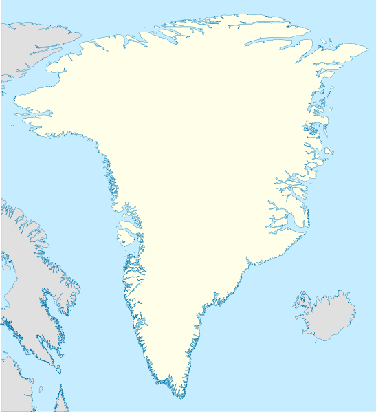
קובץ:Greenland location map.svg

גודל התצוגה המקדימה הזאת מסוג PNG של קובץ ה־SVG הזה: 547 × 599 פיקסלים. רזולוציות אחרות: 219 × 240 פיקסלים | 438 × 480 פיקסלים | 701 × 768 פיקסלים | 935 × 1,024 פיקסלים | 1,870 × 2,048 פיקסלים | 2,054 × 2,250 פיקסלים.
לקובץ המקורי (קובץ SVG, הגודל המקורי: 2,054 × 2,250 פיקסלים, גודל הקובץ: 1.57 מ"ב)
היסטוריית הקובץ
ניתן ללחוץ על תאריך/שעה כדי לראות את הקובץ כפי שנראה באותו זמן.
| תאריך/שעה | תמונה ממוזערת | ממדים | משתמש | הערה | |
|---|---|---|---|---|---|
| נוכחית | 13:07, 30 בדצמבר 2008 |  | 2,250 × 2,054 (1.57 מ"ב) | NordNordWest | |
| 21:53, 25 בספטמבר 2008 |  | 2,250 × 2,054 (1.39 מ"ב) | NordNordWest | {{Information |Description= {{de|Positionskarte von Grönland}} Quadratische Plattkarte, N-S-Streckung 280 %. Geographische Begrenzung der Karte: * N: 84.5° N * S: 59.0° N * W: 75.0° W * O: 10.0° W {{en|Location map of [[:en:Greenlan |
שימוש בקובץ
הדפים הבאים משתמשים בקובץ הזה:
שימוש גלובלי בקובץ
אתרי הוויקי השונים הבאים משתמשים בקובץ זה:
- שימוש באתר af.wikipedia.org
- שימוש באתר ang.wikipedia.org
- שימוש באתר ar.wikipedia.org
- שימוש באתר bn.wikipedia.org
- שימוש באתר da.wikipedia.org
- שימוש באתר de.wikipedia.org
- שימוש באתר en.wiktionary.org
- שימוש באתר fr.wikipedia.org
- שימוש באתר ia.wikipedia.org
- שימוש באתר ms.wikipedia.org
- שימוש באתר nn.wikipedia.org
- שימוש באתר pt.wikipedia.org
- שימוש באתר ro.wikipedia.org
- שימוש באתר sah.wikipedia.org
- שימוש באתר sh.wikipedia.org
- שימוש באתר sr.wikipedia.org
- שימוש באתר sv.wikipedia.org
- Peer
- Aasiaat
- Kap Morris Jesup
- Morris
- Kana
- Scoresby sund
- York (olika betydelser)
- Station Nord
- Nord
- Mall:Kartposition Grönland
- Godthåbsfjorden
- Mols Bjerge
- Deer Island
- Sugar Loaf
- Romer Sø
- Alannguaq Qerrilip Tasia
- Ammalortoq
- Balder Sø
- Hullet
- Karret
- Kuukuluup Tasia
- Langesø
- Orsuarnisaarajuttoq
- Qaamasoq Kangilleq
צפייה בשימושים גלובליים נוספים של קובץ זה.

